Project overview
Our Digital Capture team were appointed by one of our clients in the Buildings and Development Sector in the North West to carry out a range of digital surveys.
OUR SOLUTION
As part of the design and build of a new Educational facility for our client, large excavations were required to facilitate the enabling works phase of the project. To allow the project to progress on programme, earthworks and materials stockpiles needed to be managed to ensure a balance between excavated material stockpiles and raw materials entering site.
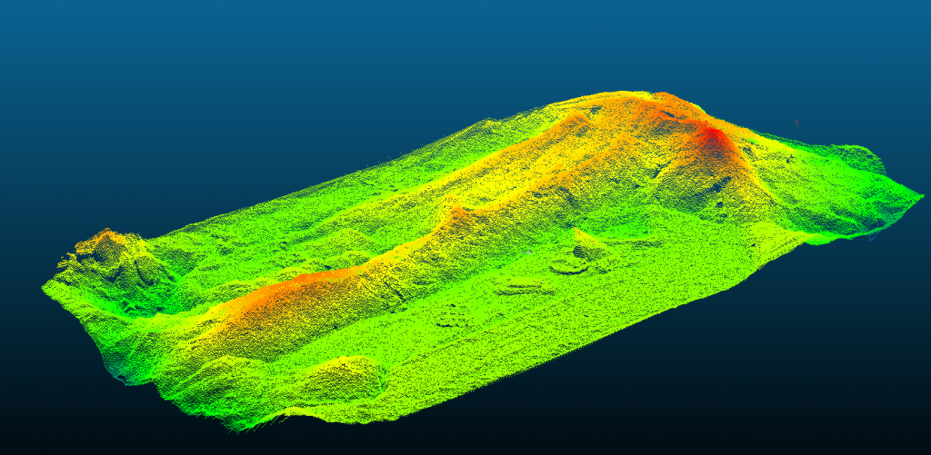
To provide a true representation of the stockpiles on site and measured outputs of stockpile volumes, our team used a combination of terrestrial laser scanning, Global Navigation Satellite System (GNSS) and Unmanned Aerial Vehicles (UAVs) to capture the site.
By combining the aerial data and GNSS data to produce a point cloud positioned on Ordnance Survey National Grid, we were able to measure each stockpile volume accurately. With each flight taking 10 minutes and processing of a point cloud being completed in a matter of hours, our client was able to quickly receive accurate volume measurements to inform site progress and project cost control.

Overcoming challenges
The biggest challenge faced on this project was working on a site tight for space and around cranes. With a busy programme there were frequent visits to site where cranes were actively present. This required careful co-ordination between our Digital Capture, the Site Team and Crane Operator, to ensure that cranes were able to be lowered and remain static during all flights.
With flights times being a maximum of 10 minutes, we worked to mitigate disruption and any loss in overall productivity to ensure flying caused no disruption to the days tasks.

Adding value
Regular flights at key intervals in the project programme with all data sets coordinated to Ordnance Survey National Grid has aloud for earthworks and materials stockpiles to be tracked and comparisons made between volumes over the project duration.
As well as capturing the volume of stockpiles on the site, images captured with the UAV also provided a point cloud of the rest of the site, with each visit providing a snapshot of the live progress on site.
This provided the client with a number of benefits which included; establishing if the overall project was hitting programme, being able to better plan site movements and prevent accidents by spotting any potential hazards.