Project overview
Our clients who are global leaders in logistics services have a commitment to providing high quality supply chain solutions, and owing to this, our Digital Capture team were contracted to provide a digital dilapidation survey at one of their Warehouse and Distribution Sites.
OUR SOLUTION
The objective of this project was to digitally capture the condition of the existing warehouse on site, in order to address any maintenance requirements, establish the utilisation of each building and discover the potential to improve space efficiency.
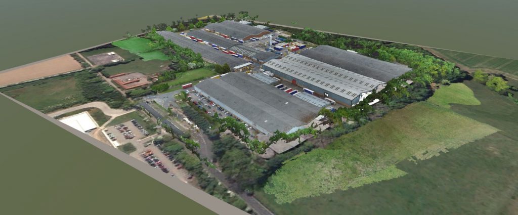
The survey included the assessment of the external and internal structure of five existing buildings, totaling approximately 450,000sqft in area, as well as the external site layout.
Overcoming challenges
The biggest challenge of the project was working on a live distribution site with hundreds of staff and moving vehicles, whilst ensuring there was little or no disruptions to the operations on-site. This was overcome by using the latest digital technology to capture the information required.
Our team of Digital Capture specialists deployed a terrestrial digital camera and Unmanned Aerial Vehicle (UAV) and an experienced Structural Engineer completed a traditional site inspection, whilst cataloging defects against photographs.
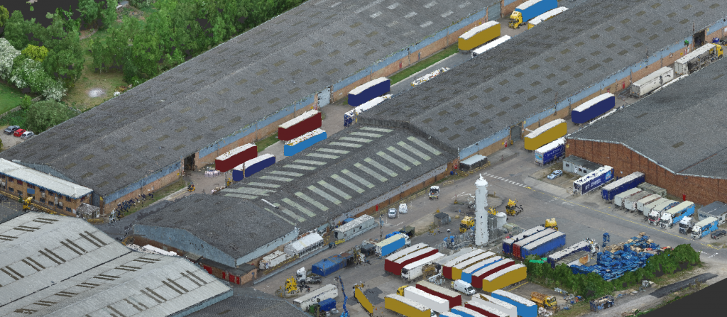
The UAV was able to digitally capture the entire external site from an altitude of 50m ensuring no disruption to vehicle movements. Inside the warehouse buildings, a terrestrial camera was used to capture 360 degree panoramas at key locations to provide a detailed visual record of each warehouse.
Each 360-degree panorama took just 4 minutes to capture, and with the equipment easily mounted to a tripod, the Digital Capture team were able to quickly work around each building and ensure each key location was not in the path of any vehicles or staff movements, resulting in minimal disruptions to operations.

Adding value
During the post-capture processing, any moving vehicles/personnel were removed to ensure clean and high quality panoramas. The panoramas were then used to create a virtual tour of each building, with the ability to move around the space by using hot spots to jump between panoramas. As well as producing a traditional interactive defect report, within each panorama of the tours, defects were tagged at their precise location allowing the client to easily locate the issue. Included in the tag was a description of the defect as well as a close up photograph to ensure the client could clearly see the issue, even if obscured by objects within the panorama. Each tour also contained floor plans of the buildings showing the location of each panorama to further aid the client in navigating the tours and navigating through buildings.
Images captured via the UAV were processed by our Digital Capture team to produce a single high quality orthomosaic of the entire site. By utilising the latest UAV technology we were able to produce an orthomosaic with a ground sample distance (GSD) of 2.3cm/pixel. After processing, the orthomosaic was incorporated into each tour, allowing external site defects noted by the Structural Engineer to be incorporated as well as internal building defects.
Results
The development of our terrestrial Digital Capture and UAV solution allowed our team to minimise disruption to a very busy site, creating a comprehensive digital dilapidation survey.
We provided the client with an immersive tour of their entire facility allowing the exact location of defects to be clearly identified within a contextual environment, along with the production of an overall description of the condition of the site.
This was delivered in a time and cost effective way, mitigating risk whilst on a live site, and ensuring minimum disruption to on-going operations.